
 11 hours Ago By Sahan Weerasooriya
History In 1934 the State Council of Ceylon decided that an airport with easy access to Colombo was a necessity and declared that Ratmalana was the best site available. Accordingly, an airfield was built, and the first landing took place on 27 November 1935 at what became Ceylon’s first dedicated aircraft landing ground. During World War II the airport expanded, and a ‘hard’ runway was built.
To assist aircraft landing in bad weather and resulting bad visibility, a transmitter was built at Talangama to generate a radio signal beam, called a ‘radio range’, directed along the extended centreline of the Ratmalana runway. If the aircraft was tracking along the correct path, pilots would hear a continuous tone in their headsets. However, if they were left of the desired track, they would hear the letter ‘A’ transmitted in Morse Code (‘dit-dah’); or if right of the beam, the Morse letter ‘N’ (‘dah-dit’).

The objective was to hear a continuous signal guiding them toward Ratmalana along the extended centreline of the runway. Later, a low-frequency Non-Directional Radio Beacon (NDB) transmitter was installed at Attidiya in the vicinity of the airport, and used in conjunction with an Automatic Direction Finder (ADF) onboard the aircraft. A needle on a compass dial in the aircraft pointed to Attidiya, giving directional guidance.
Although this system was useful, when most needed, for example during thunderstorm activity, there was static interference and the needles pointed toward the storm instead of at Attidiya. So, a Very High Frequency Omni Directional Radio Range (VOR) was installed for more accuracy and reliability. After WW2 Ratmalana Airport was served by a few international airlines such as Air Ceylon, Indian Airlines, BOAC (British Overseas Airways Corporation) and TWA (Trans World Airlines).
But in 1968 the airport lost its ‘international’ status when Bandaranaike International Airport opened and all international operations moved to Katunayake. Subsequently, the equipment at Ratmalana was allowed to deteriorate; radio navigational let-down aids were no longer operative, and there was no proper control tower. The civil training aircraft of the government’s flying school had neither radios nor radio aids to navigation.
Even the runway lights didn’t work, and domestic flights had to depend on kerosene lamps to demarcate the runway limits. Flares from oil lamps were the guiding light for all traffic landing at Ratmalana Airport. One redeeming grace, in the night, in those days, was that the Sapugaskanda Oil Refinery was in full production and a giant flare of the burning gasses was the guiding light to all domestic traffic landing at the Ratmalana Airport.
The Pilots spotted the flare from far away and flew over the Refinery and then turned on the runway heading and could see the runway edge kerosene flares, flickering dimly in a dark patch that was the Ratmalana airport! Post-1977 and the Dharmista government, another problem was created for Ratmalana operations. Sri Lanka’s capital was moved to Sri Jayewardenepura, Kotte, and a new Parliament complex built there. Unfortunately, the parliamentary precinct was only 3.
6 nautical miles (NM) from the end of the Ratmalana runway ‘as the crow flies’, and less than 1 NM from the Talangama transmitters. In most countries overflying the Parliament is prohibited, and Sri Lanka decreed it wouldn’t be an exception to the rule. This decision was detrimental to freedom of aircraft movements to the Ratmalana runway, preventing longer, safer, conventional landing approaches.
At the time Air Ceylon, the Sri Lanka Air Force (SLAF) and other domestic flights were still using Ratmalana airport. Many professionals observed that it was akin to someone building a house near an existing railway line and then complaining that it was too noisy and requiring the railway to divert. This is not unlike the widely-known ‘NIMBY’ phenomenon: Not In My Back Yard.
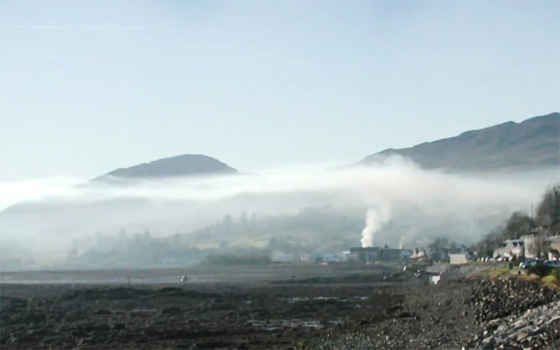
Consequently, aviators had to accept the non-availability of precision navigational aids at Ratmalana as the Talangama transmitters lost their significance. The Urban Development Authority (UDA) eventually took vacant possession of the Talangama precinct, and the Sri Lanka Army’s Gemunu Watch infantry regiment established a camp there. During December’s clear nights and cooler mornings, temperature inversions combined with the northeasterly winds blowing smoke from the Sapugaskanda Oil Refinery seriously compromise visibility on the final approach to Ratmalana airport.
(See image 1) On the morning of 14 December 2014, a SLAF Antonov An-32 transport aircraft on a ferry flight from Katunayake attempted to approach for landing at Ratmalana airport and crashed. This prompted the then Air Force Commander to write to the then Director General of Civil Aviation (DGCA) to reinstall navigational facilities (see letter below). Now, after almost 11 years, Airport and Aviation Sri Lanka (AASL) is slowly realising that not only the ‘seen’ but also ‘unseen’ facilities at Ratmalana should be brought up to international standard in the name of air safety.
Wide publicity was given to the fact that the government’s intention was to make Ratmalana an international business aircraft hub by way of regaining its past importance. In fact, it is now known as the Colombo International Airport Ratmalana (CIAR). (See image 2) Image 2 Meanwhile, another security-sensitive building has been erected and commissioned on vacant land at the former site of the Talangama transmitters, barely 1 NM from the Parliament and 4.
4 NM from the Ratmalana runway end. That is the Akuregoda Military Head Quarters, which has created an effective manmade barrier to limit operation of legitimate air traffic to Ratmalana, consequently imposing more restrictions on inbound operations. Furthermore, it appears that there was no ‘master plan’ for Ratmalana International Airport, in a case of the left hand not knowing what the right hand was doing.
(See image 3) Air safety dictates that jet aircraft should have at least an 8 mile straight-in (no turns) final approach. Now it is not possible to do that with the unplanned presence of sensitive buildings on the final approach to Ratmalana. Ideally, as in other countries, all three parties – the local municipality town planner; Civil Aviation Authority/ Airport and Aviation Ltd (CAASL/ AASL); and building developer – must make these long-term decisions.
In Australia, for instance, the Civil Aviation Safety Authority and relevant airports authorities have control of manmade obstacles for a radius of 25 miles. In Sri Lanka, unplanned buildings, called ‘man-made relief’ as against ‘geographic relief’ (terrain), have compromised feasibility of the intended city airport. Another example is the General Sir John Kotelawala Defence University (KDU), the tallest building in the vicinity of Ratmalana Airport that should never have been allowed to be built that high.
This is symptomatic of a malady the entire country is suffering from: people in the know are afraid to speak up. Subsequently, no one is held accountable for these poor, uncoordinated decisions without true professionals being consulted, resulting in tunnel vision. As a pithy Sinhala saying goes, “ledaa malath, bada suddai” (‘although the patient died, the bowels were clean’).
Accommodating ‘business jets’ (‘bizjets’, or executive jets) at Ratmalana Airport will be a good source of revenue, and a step in the right direction. Putting aside criticism of how Ratmalana Airport was allowed to run down, I write to offer a practical solution to mitigate the adverse effects of unplanned buildings. While the Akuregoda military base is working around the clock, the overflying prohibition may be justified.
But Parliament sits only on certain days and for limited hours. Therefore, the authorities should provisionally allow air traffic, inbound to Ratmalana, to overfly the Parliament complex on days and times when there are no sittings. A Notice to Airmen (NOTAM) to that effect could be issued as and when necessary.
The over-flight of the Parliament would become ‘Restricted Airspace’, not ‘Prohibited Airspace’. With airspace thus shared for the benefit of all users, longer and therefore safer approaches could be designed to facilitate those small but fast bizjets from overseas operating in and out of Ratmalana Airport. The differences in airspace regulation and restrictions are as published by the International Civil Aviation Organisation (ICAO).
Restricted Area/Airspace is defined as an area of airspace where flight is permitted only under certain conditions. These conditions may include obtaining permission from the airspace’s controlling authority, flying at a certain altitude, or following a specific route. Restricted airspace is typically used for military training, testing, or other activities that require special precautions.
A restricted area is an airspace of defined dimensions above the land areas or territorial waters of a state, within which the flight of aircraft is restricted in accordance with specific conditions. (ICAO Annex 2: Rules of the Air) Prohibited Area/Airspace is an area of airspace where flight is completely prohibited. This type of airspace is typically established for national security reasons, such as protecting sensitive government facilities or military bases.
In some cases, prohibited airspace may also be established for safety reasons, such as around airports or other areas with high levels of air traffic. A prohibited area is an airspace of defined dimensions, above the land area or territorial waters of a state, within which the flight of aircraft is prohibited. (ICAO Annex 2: Rules of the Air) Furthermore, Ratmalana Airport lacks a proper Control Tower with a 360-degree range of visibility of the airport area.
It is time to ‘think out of the box’. A new Control Tower could be sited in the highest point in the vicinity. Perhaps at the KDU building to mitigate the situation.
At Wellington Airport, serving the capital of New Zealand, the control tower is on top of a shopping mall! (See image 4) Image 4: Wellington Airport, New Zealand, control tower above a shopping Mall A, research shows that light training aircraft and other small aircraft of the size and mass of business jets cannot create catastrophic destruction to strong buildings such as our Parliament or the Akuregoda military base, similar to what happened on September 11, 2001 in the USA with large passenger jets. (See image 5) The Current Status at Colombo International Airport Ratmalana. A map of Ratmalana Airport with heights of significant obstacles.
The height above Mean Sea Level (MSL) is the first figure. The height above the airport reference point is within brackets. Note: The KDU is 212 ft.
above MSL, standing at a height of 190ft. (See image 5) Although publicised as an ‘international airport’, Ratmalana does not even have a ground-based precision electronic navigation or landing aid such as a Very high Frequency (VHF) Omnidirectional Radio range (VOR) or an Instrument Landing System (ILS). An excuse for that lack is that unplanned buildings such as the Sri Lanka Air Force Museum are obstructing navigational signals.
Even if ground-based radio navigational aids are not available, modern satellite-based navigational aids such as a Global Positioning System (GPS) could be used. India has already launched satellites into space and positioned a Geo-Augmented Navigation (‘GAGAN’) satellite for GPS navigation over this part of the world. Unfortunately, Sri Lanka has failed to request India to share use of the system.
In the above map ‘RM’ (top left) is the NDB situated at Attidiya, and is not aligned with the extended centreline of the existing runway. The Ratmalana terminal building was built in the likeness of many ‘colonial’ airports in the 1950s. It was often used for international movie backdrops.
Unfortunately, the airport administration demolished parts of this historic terminal to accommodate an ugly temporary structure. There is still no air traffic control tower conforming to international standards with a 360-degree view. From the building that is being used, air traffic control officers cannot see the south side of the airport and the runway at the Galle Road end.
The author (5ft 6in tall) beside the controversial hazardous wall at Colombo International Airport, Ratmalana Speaking of the Galle Road end, there is still that concrete (or cement brick) wall which is considered a hazard by all experienced pilots, yet the authorities continue to ignore demands for its removal. To clarify, a hazard, according to EASA (European Union Aviation Safety Agency), is “a condition or an object with the potential to cause or contribute to an aircraft incident or accident.” The EASA goes on to state that one way of identifying a ‘hazard’ is accepting the opinion of experts with professional knowledge.
Accordingly, 22 very experienced pilots with experience totalling 330,500 hours petitioned the then Director of Civil Aviation to remove the concrete wall at Colombo International Airport Ratmalana and replace it with a frangible fence. The letter is produced below. 2nd November ‘18 The Director General, Civil Aviation Authority, Minuwangoda Road, Katunayake.
Dear Sir, The Concrete Wall at the Galle Road End at the Ratmalana Airport Attached herewith is a petition signed by 22 very experienced pilots, who feel strongly about the presence of the concrete wall at the Galle Road end of the Ratmalana Airport. The petitioners have a total of 330,500 hours and consist of a cross-section of some of the most experienced pilots in the land. It is hoped that you will heed their call and at least get the process going.
Thanking you in anticipation. Yours truly, Capt. G A Fernando The author (5ft 6in tall) beside the controversial hazardous wall at Colombo International Airport, Ratmalana But the airport authorities couldn’t care less.
I believe that the main reason for this sad situation is that none of the present airport administrators are or have been aviators. “If you think that Air Safety is expensive, try an accident” Jerome Lederer, President, Flight Safety Foundation, USA [email protected] The Writer is Immediate past President, Aircraft Owners and Operators Association (AOAOA) RCyAF/ SLAF, Air Ceylon, Air Lanka, Singapore Airlines (SIA), SriLankan Airlines President, Colombo Flying Club.
President, UL Club (an Association of Former Air Lanka and SriLankan Airlines Employees) Life Member of the Organisations of Professional Associations (OPA) by Capt G A Fernando MBA (UK).