 1 week Ago
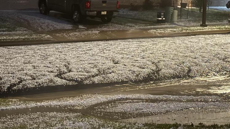
GEORGETOWN, Texas — Strong thunderstorms and major hail slammed parts of Central Texas on Tuesday. Pictures and video sent into KVUE showed so much hail that it almost looked like snow! Tuesday's storms started popping up just south of Austin before bringing in some needed heavy rain across the area. However, once those storms got further north, they intensified and even led to a few Severe Thunderstorm Warnings.
Some of the hail reported in Georgetown ranged from golf ball-sized hail to tennis balls. How much rain fell on Tuesday? Rain totals from the Lower Colorado River Authority showed anywhere from 0.2 inches of rain in South Austin to 1.

28 inches of rain near Shoal Creek at West 45th Street. Another round of storms is possible for Wednesday as storms move in from West Texas along a dryline. Additional scattered downpours and storms are likely Wednesday afternoon and evening, with the possibility of locally heavy rain and some gusty winds.
That pattern will continue through Friday with pop-up showers and storms before our weather pattern trends drier and hotter for the weekend..